Old Plank Road Trail
On-line map of OPRT trail
Click on the small map below to enlarge the map to the size of your monitor or screen.
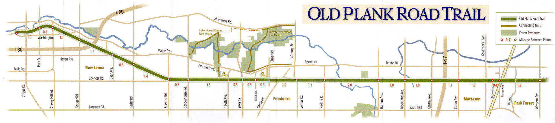
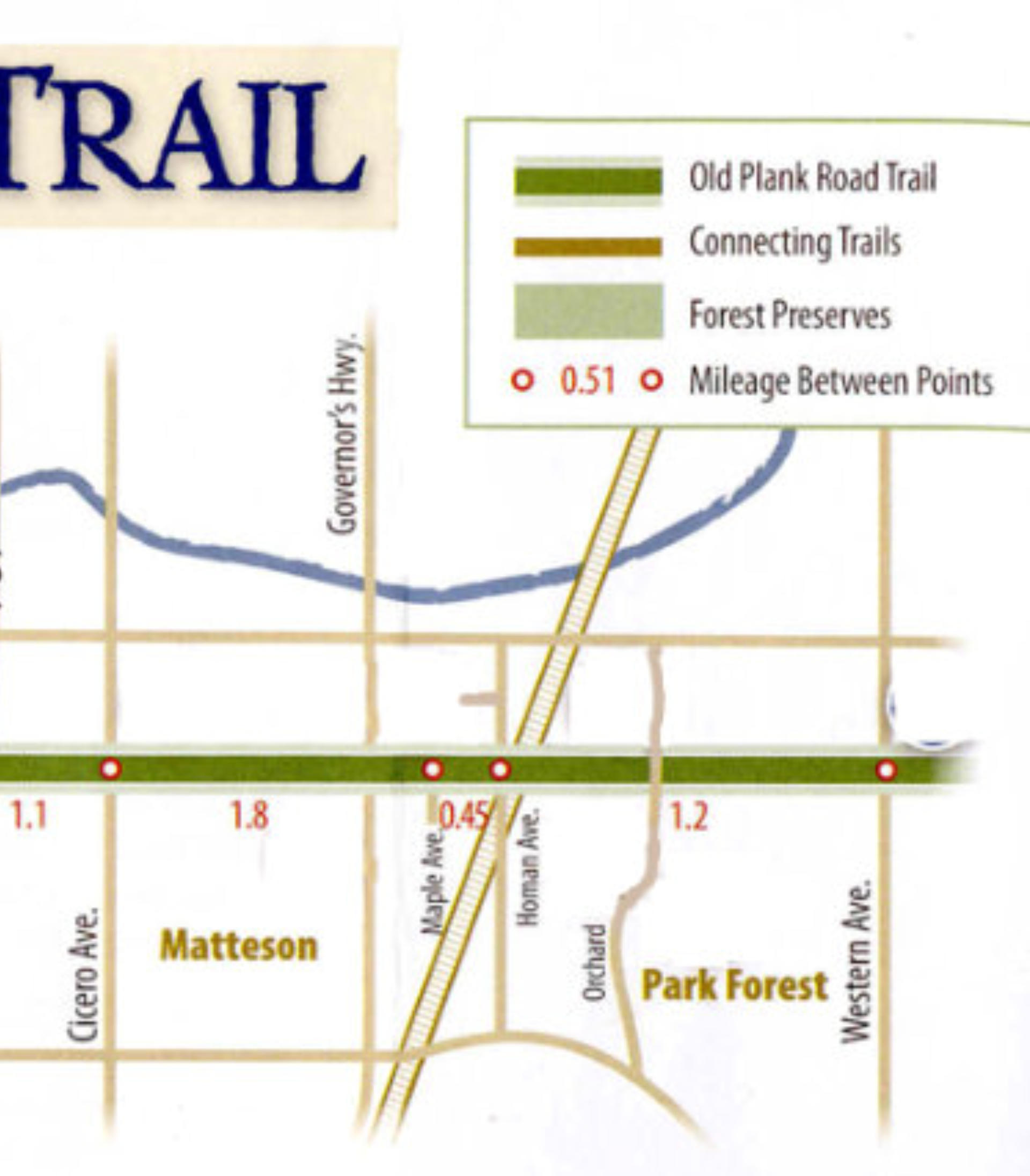
Old Plank Road Trail map with points of interest
Take a tour of the trail with pictures and descriptions of sights along the trail. Click here to go to the other
OPRT map page that features pictures and descriptions of the attractions along the trail keyed to the map.
Parking and Trail Access
There are dozens of streets and roads that cross or abut the OPRT. Many of them provide convenient access to
the trail with parking.
Public trail access points with lots of free parking include:
•
The western end of the trail on Park Road in Joliet (about 1/2 mile south of U.S. 30, also know as Lincoln
Highway).
•
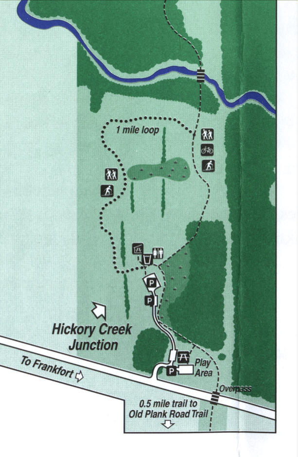
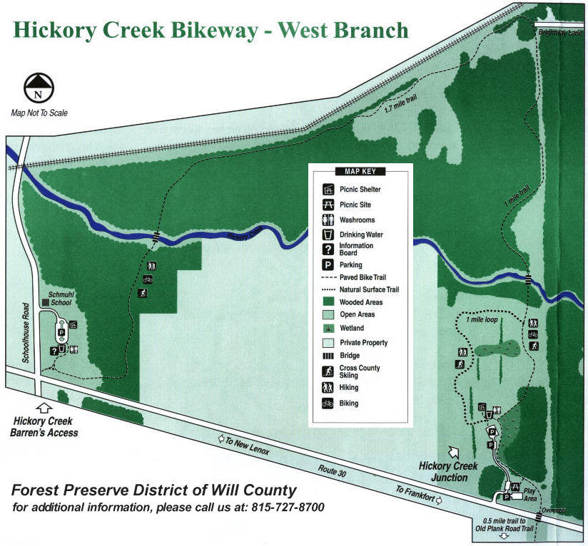
Hickory Creek Junction in Mokena, which is on U.S. 30, has excellent parking and recreational facilities
including picnic facilities, a playground, water and bathrooms.
•
Frankfort's Historic District & Breidert's Green on White Street provide excellent parking, water
fountains, bathrooms, picnic tables, restaurants, shopping and more.
•
The northeast corner of the Target Store parking lot, just west of Cicero Avenue and about 1/2 mile south
of U.S. 30 is a popular parking and access point. A kiosk with trail information, railroad artifacts and
maps is located at this point.
•
Logan Park just east of Orchard Street in Park Forest, features a good parking lot, public washroom
facilities, a picnic pavilion, And a playground.
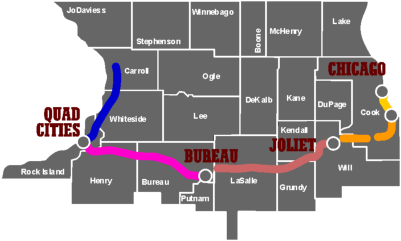
More Trails in Northern Illinois
You can bicycle or walk on public trails from Michigan to the Mississippi River. Click on the maps below to go
to websites with more maps and trail information.
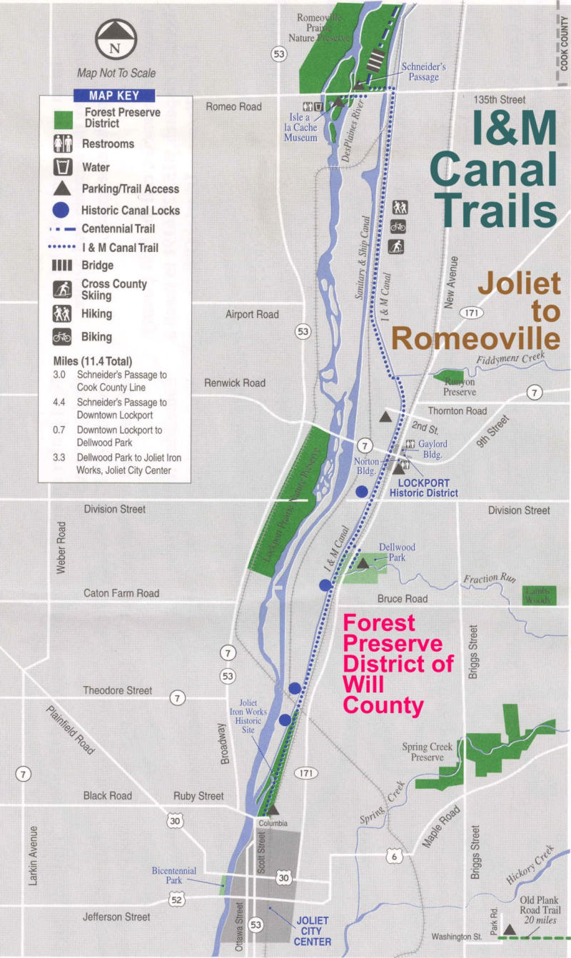
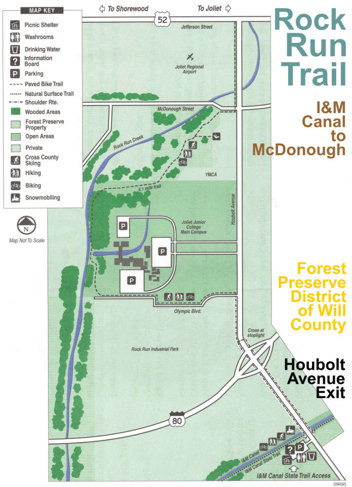
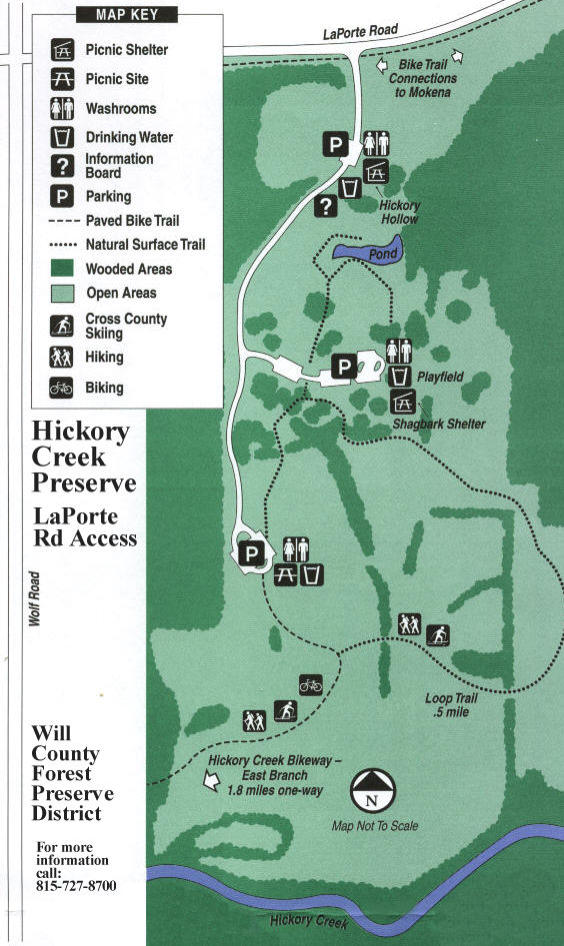
Forest Preserve District Trail Maps
OPRT paper maps are available at a number of locations. The links below will take you to the map pages on
the Forest Preserve District websites for COOK and WILL Counties:
Will County FPD Preserve and Trail Maps On-Line
Cook County FPD Trail Maps On-Line
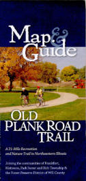
Map & Guide
click the cover to bring
up an Adobe Acrobat
version of the 18 by 24
inch Map and Guide to
the Old Plank Road Trail
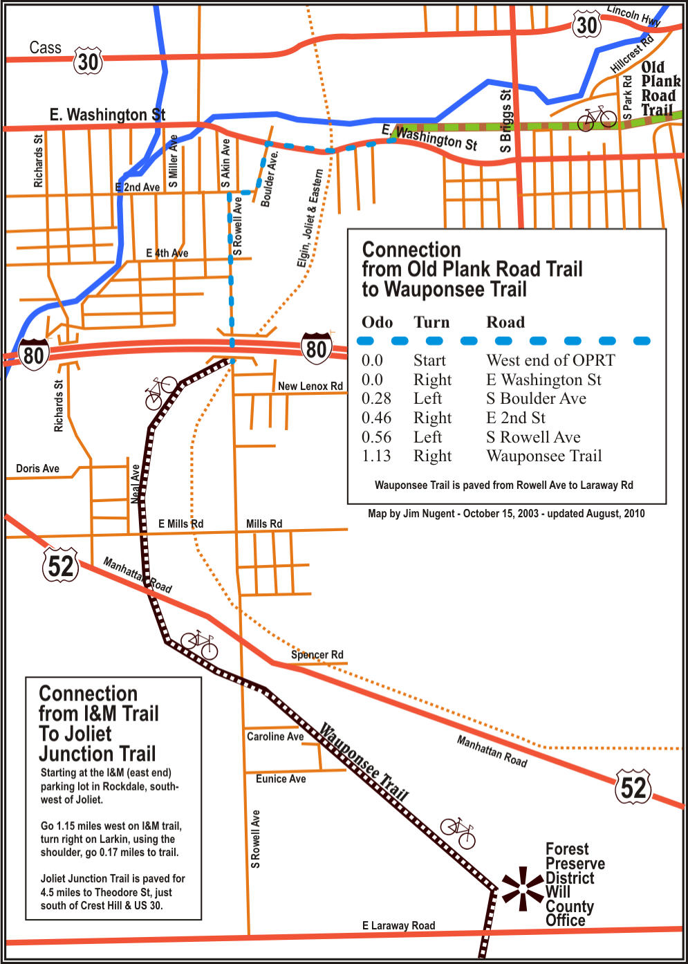
West end
connection to
Wauponsee
Trail
click the map to the right
to get directions from the
western end of the OPRT
to downtown Joliet and
other trails.
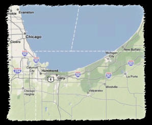
Trails Near
the OPRT
click the maps for
information on trails
near the OPRT.
Chicago
Heights
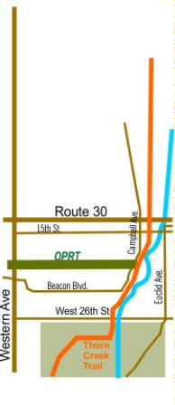
East end connection to Thorn Creek Trail
Matteson
Park
Forest
Now extends to
Campbell Ave.
Chicago Heights


Old Plank Road Trail
A 22-mile recreation and nature trail in northeastern Illinois


